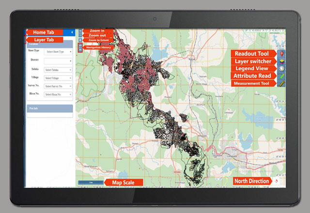
LIS Introduction

It is an online Land Information System used for cadastral and land-use mapping. Land Information is a valuable information and it is served as a key to financial investments, commerce, industry and agriculture. It facilitates urban and rural users & government officials for smart decision making. It is an aid for planning and development. It consists of land records and associated attributes as well as spatial information. It makes easy to retrieve, create, update, store, view, analyze and publish land information. It is an integral part of government, non profit and private sector activities.

Web Based LIS:

Multiple users can access the information online.
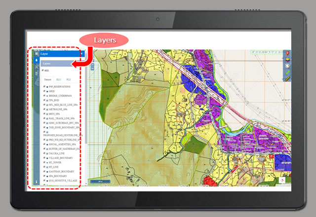
Role Based Access:

Only Authenticated users can make alterations in the land map with the approval of supervisor.
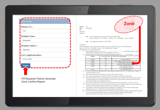
Online Reports:

Reports can be generated and issued to customers through online mode by taking applicable fees.
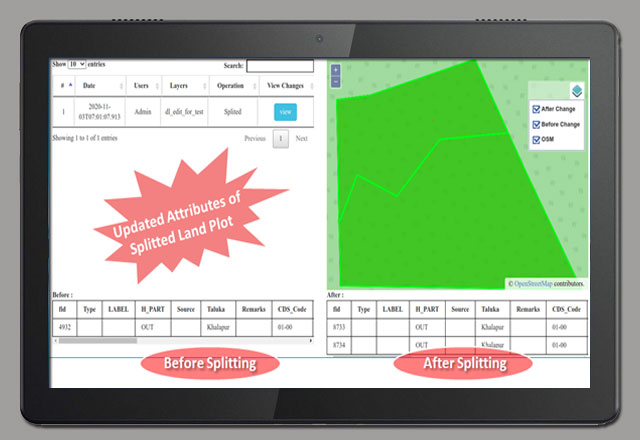
Auditing:

System records all information related to modifications /alterations to land plot (e.g. timestamp, spatial/non-spatial attributes) which can be accessed in future.

Blockchain:

Integration of LIS with Blockchain adds following values to the system.: Multiple Stakeholders: Various departments can be given Ownership and Responsibility of their data or Spatial Layers. Data is more secure as copy of data is with every Stakeholder. Data becomes tamperproof due to Immortality feature of Blockchain. Creates Trust and Transparency among all Stakeholders.

FEATURES

The Blockchain technology has the ability to revolutionize the future of geospatial world.

Major Tools

More than 20 Tools are available as per the requirement.

  • Contour Readout Tool
  • Location Readout Tool 
  • Measurement Tool
  • Snapping Tool
  • Zoom to Fit Tool
Spatial Layers
  • It is a multilayered system and each layer comprising data which relates to a particular theme. 
  • Spatial layers can be categorized into logical groups and such groups or individual layers can be rendered on screen


Online Reports
  • Zone Confirmation Report.
  • Zoning, is the allocation of land by dividing them into different zones.
  • The purpose of zoning is to protect and conserve the value of land use.
  • Zone confirmation report can be issued in pdf format to user for given khasra (plot).


Auditing of Attributes of Land Plot

All spatial and/or non spatial attributes of land khasra (plot) can be updated. Such modifications happening on khasra (plot) are recorded and can be used in auditing process. Any modifications done by authorized users are recorded and are approved by concerned authority before publishing them.

Contact Us

Featured Links

Renewable Energy
Net Zero Carbon
Blockchain
Energy
Paperless Office
Peer to Peer

Newsletter

Subscribe and get our weekly newsletter
We’ll never share your email address

© 2020 Orange Current Technologies Pvt. Ltd. All rights reserved